REVIEW · HAUGESUND
Haugesund: Himakånå Guided Hiking Trip
Book on GetYourGuide →Operated by Viking Adventure AS · Bookable on GetYourGuide
Fjord views come fast here. This Haugesund cruise-area hike takes you from the pier into the fjord communities and up to Himakånå (357 meters), with the reward of panoramic fjord-and-mountain views plus a proper Norwegian matpakke lunch at the top. It’s guided, structured, and built for photos without feeling like a factory tour.
The one real caution: the trail is steep gravel. You’ll hike about 2.2 km with uneven footing, and while the guides adjust pacing, a less-fit group can end up with less time at the summit. On a warm day, that uphill grind can feel bigger than you expect.
The rest is a very good deal for a 5-hour shore excursion. You get cruise-pier pickup and drop-off, a live English guide, and a small group capped at 15, so you don’t get swallowed by crowds. If you like moving at a human pace with real local context, this one fits.
In This Review
- Key highlights to know before you go
- From the cruise pier to Nedstrand: the fjord drive that sets the mood
- Matpakke in Nedstrand: Norwegian lunch you’ll actually enjoy
- The Himakånå climb (357 moh): steep gravel, uneven footing, and real uphill time
- Summit time at the Himakånå selfie spot: photos, views, and a slower moment
- The guide experience and pacing: what you’ll notice in the first hour
- Logistics that matter: meeting point, timing, and how the day flows
- Packing and fitness: how to make this steep gravel feel fair
- Price and value for a 5-hour Haugesund shore excursion
- Should you book the Haugesund: Himakånå Guided Hiking Trip?
- FAQ
- Where do I meet for the Haugesund Himakånå hike?
- How long is the tour in total?
- How hard is the hike to Himakånå?
- What will I do at the summit?
- What’s included in the price?
- Is this tour suitable for wheelchair users or mobility impairments?
Key highlights to know before you go
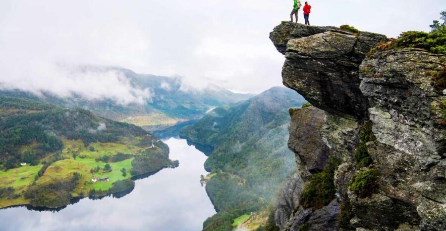
- Himakånå summit at 357 meters with about 1 hour uphill and 1 hour down
- Matpakke lunch in Nedstrand picked up from a local grocery store
- Small group limit of 15 with guides adapting to the group’s pace
- Haugesund sightseeing and narration while traveling through the Haugalandet region
- A famous selfie spot at the top, plus time for photos and a summit break
From the cruise pier to Nedstrand: the fjord drive that sets the mood
Your day starts at the cruise pier with the Viking Adventure stand, a red hut marked by a big green Viking Adventure flag. Before you start, you’ll exchange your voucher at the ticket counter, then meet the group and get checked in. It’s a simple setup, but do build in a little buffer so you’re not rushing right at ship departure time.
Once everyone is together, you’ll board a comfortable bus or car and head toward Nedstrand in the fjord area. Along the way, your guide shares stories about the region and the Haugalandet people—small history beats that make the scenery make sense. It turns the drive into more than transport.
In Haugesund, you’ll also get a guided sightseeing stretch and a safety briefing. This matters because it prepares you for the hiking terrain and helps you know what to expect. Even if you’re a confident walker, getting the ground rules early makes the climb feel safer and less chaotic.
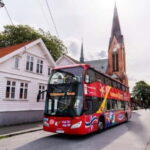
There’s also a short pause for a photo stop and quick time for a walkabout and shopping. The goal here isn’t to shop your way into exhaustion; it’s to let you grab something small, stretch a bit, and reset before the hike starts.
You can also read our reviews of more guided tours in Haugesund


Matpakke in Nedstrand: Norwegian lunch you’ll actually enjoy
The lunch stop is one of the smartest parts of the tour. In Nedstrand, you pick up your matpakke (a light Norwegian packed lunch) at a local grocery store. That little detail changes the whole vibe: instead of tasting food that could be from anywhere, you’re eating something that feels tied to the place you’re hiking.
You’ll have water included too, which is a big deal on a steep hike where you’re likely to sweat more than you planned. At sea level you might feel cool, but once you start climbing, your body will tell you the truth fast.
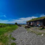
At the summit, you get time to sit and eat without the pressure of squeezing lunch in while standing. The break is built into the hike schedule, so it doesn’t feel like an afterthought. And yes, the summit is a photo magnet—so you’ll have that moment of eat-and-look, eat-and-shoot, repeat as needed.
If you’re the type who likes a tour that includes food but doesn’t turn into a picnic circus, this works well. It’s simple, practical, and timed for comfort.
The Himakånå climb (357 moh): steep gravel, uneven footing, and real uphill time
This is the heart of the experience, and it’s where you should make your reality check.
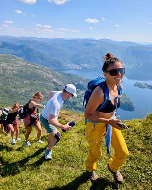
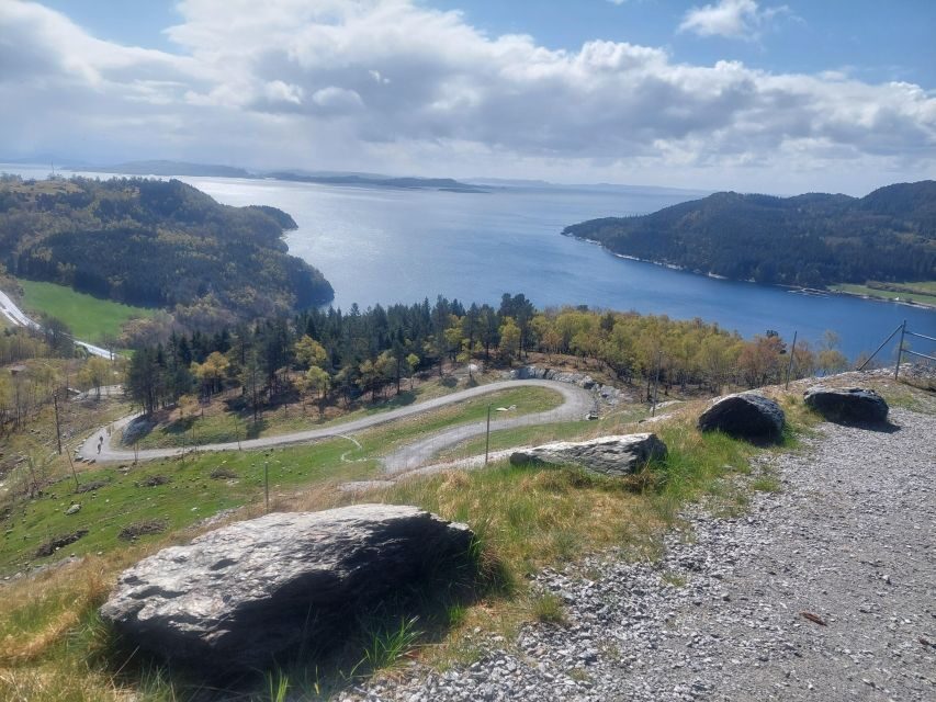
The trail covers about 2.2 kilometers of steep gravel. Your climb goes from near sea level up to 357 meters above sea level, so you’re gaining elevation steadily, not just walking through a valley and calling it a hike. The route includes uneven terrain, which is why the shoe choice matters.
Timing-wise, you’re looking at about 1 hour up and 1 hour down. That doesn’t mean the hike is flat and steady. In practice, some sections feel much more “push uphill” than “pleasant stroll,” especially if the ground is loose gravel underfoot. That’s also why the tour advises an element of fitness.
Guides can adapt to the group, which helps a lot. On tougher days, the pace can slow, and that can affect summit time. One clear theme from the experience is that you should expect the trail to be steep and treat it like a workout you can manage, not like an easy walk.
Shoes are not optional advice here. Wear sports shoes or hiking shoes with decent grip. If you show up in slick soles, you’ll feel it on the gravel. I’d also recommend outdoor clothing that can handle wind and cool air, even if the forecast looks mild.
Sun protection is recommended too, because when you’re exposed on higher ground, you’ll feel the sun. A cap and sunscreen go a long way toward keeping the day comfortable.
Summit time at the Himakånå selfie spot: photos, views, and a slower moment
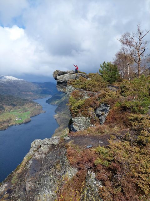
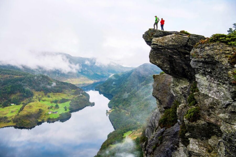
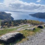
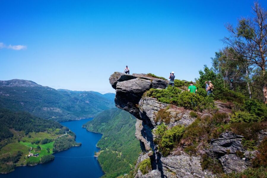
Reaching the top is the payoff. The viewpoint at Himakånå is one of Norway’s most popular selfie spots, and you’ll see why the moment you step out. From 357 meters, you get wide panoramic views across mountains and the fjord area.
Once you arrive, you’ll have a break and time for photos. The schedule gives you a chunk of rest and lunch at the summit, plus free time to walk a bit and settle into the view. This part is where the tour stops feeling like exercise and starts feeling like a memory you’ll want to pull up later.
Because this is a popular spot, you’ll want to be strategic with your timing if you care about photos. Get your key shots early, then use the remaining time to sit and enjoy the view without feeling rushed. The better you pace yourself uphill, the more relaxed you feel at the top.
Also, plan for changing light. If the day is clear, the views feel crisp and dramatic. If clouds slide through, you still get plenty of texture in the mountains and fjord, but your photo results can shift fast. Keeping your break flexible helps you catch better moments.
This is also the moment when your guides’ pacing choices pay off. If the group moves well uphill, you’ll likely enjoy a full summit experience. If the group is slower, you may find the summit break tight, so you’ll want to prioritize your must-do photos and lunch first.
The guide experience and pacing: what you’ll notice in the first hour
A good guide turns a strenuous hike into a manageable one. In this case, the narration starts even before the trail. During the bus ride, you’ll hear regional context and history about the Haugalandet area, plus explanations that make the route feel purposeful.
Safety briefing happens early too, which helps you understand how the hike will be run. That’s especially useful on uneven gravel, where your balance matters and where “single file and watch your step” is more than a slogan.
One guide name that stands out from the experience is Howard. People specifically praised him for being engaging and for bringing the region to life while you travel to the trail head. That kind of storytelling doesn’t just fill time. It makes the drive and waiting feel worth it, so you don’t start the hike bored or grumpy.
The other pacing factor is how guides handle slower hikers. You’ll notice when someone needs to move at a gentler rate: the guide can adjust and keep things organized so nobody feels stranded. In some cases, that may also mean the summit time gets shortened if the group runs late, so it’s smart to be honest about your fitness level and start strong without overcooking it.
Logistics that matter: meeting point, timing, and how the day flows
This is designed for cruise passengers, and the schedule reflects that. You’ll start at the cruise pier, then return to the same general area after the hike and sightseeing. The overall duration is listed as 5 hours, which is a tight but realistic window for a short uphill climb, a summit break, and a return.
You’ll spend time in Haugesund for guided sightseeing, then a quick break segment with photo time and shopping. Then you’ll drive to the trail area, hike to Himakånå, eat and rest at the summit, and hike back.
The key practical point is this: the biggest variable is you. The hike length and elevation gain are fixed, but your pace determines how much summit time you feel you get. If you’re worried, plan to hike steadily and take short pauses as needed rather than stopping frequently for long periods.
The guide team is there to keep things smooth. Still, you’re the one carrying your water and lunch plans. Being prepared is what turns this from stressful into enjoyable.
Packing and fitness: how to make this steep gravel feel fair
This trip is rated for people who can handle uneven ground and a steep climb. It’s not suitable for wheelchair users and it’s also not recommended for people with low fitness or mobility impairments. That’s not being dramatic—it’s simply the terrain reality.
If you do go, treat this like a workout with a view at the end.
Bring outdoor clothing and sports or hiking shoes with grip. Think traction first, not style. You’ll be walking on gravel, so you want stable footing. If your shoes are fine for flat streets but not for loose rock, you may struggle more than you expected.
Sun protection is recommended. Even in Norway, strong daylight at higher exposure can sneak up on you. If you’re sensitive to heat, consider a cap and breathable layers.
Weather can change quickly in coastal regions. Dress in layers so you can peel off or add a jacket depending on wind and temperature. And if you get warm on the ascent, remember that the descent can feel cooler, especially with wind.
One more practical tip: pack your expectations. This hike takes about an hour up for many people, but it’s steep enough that it can feel more challenging than the distance suggests. You’ll climb from sea level to 357 meters, so go into it prepared to work.
If you’re traveling as a family, pick the right age and fitness mix. The hike isn’t described as a kids’ stroll, and younger hikers will need solid balance and comfort with steep gravel.
Price and value for a 5-hour Haugesund shore excursion
At $249 per person, this isn’t a budget “walk-and-take-photos” tour. You’re paying for the full package: cruise pier pickup and drop-off, an English live guide, a small group size capped at 15, and a guided hike to a specific summit viewpoint.
You also get a packed lunch and water included. That matters because you won’t spend time hunting food in between transport and hiking. The matpakke stop is planned, and it’s part of the experience rather than a quick roadside purchase.
Value comes from two places. First, the hike itself is a focused route with a clear endpoint and a payoff view. Second, the guide adds interpretation during transit and helps manage the pacing on uneven terrain. If you like guided structure and you’re happy to pay for convenience plus a real destination, this price can feel fair.
If you’re traveling on a tight schedule or want a guided hike rather than solo navigation, the “5 hours from the cruise” format is also a value point. You’re not spending your afternoon figuring out routes, transport timing, and where to stop for food.
Should you book the Haugesund: Himakånå Guided Hiking Trip?
Book it if you want a guided hike with clear objectives, fjord-and-mountain views, and a summit break for photos and lunch. It’s also a good match if you like small groups and you’d rather have local context than just scenery.
Skip it or choose a gentler option if steep gravel is a problem for you. If low fitness is an issue, or if mobility is limited, this isn’t a good fit. Also, if you hate uphill walks or you need lots of time at the top regardless of pace, go in with eyes open, because summit time can shrink when the group struggles on the climb.
My rule of thumb: if you can comfortably walk uphill for about an hour on uneven ground, you’ll likely find this rewarding. If not, you’ll feel it fast, and the views won’t be enough to erase the discomfort.
FAQ
Where do I meet for the Haugesund Himakånå hike?
Meet at the Viking Adventure stand (a red hut) on the cruise pier. Look for the big green Viking Adventure flag, and exchange your voucher at the ticket counter before the tour begins.
How long is the tour in total?
The tour duration is listed as 5 hours.
How hard is the hike to Himakånå?
The hike is about 2.2 kilometers on a steep gravel path. It climbs from sea level to 357 meters above sea level, and it takes about 1 hour each way. Sports or hiking shoes and outdoor clothing are recommended.
What will I do at the summit?
You’ll have a break time with photo stops, plus you’ll eat your packed lunch (matpakke) and enjoy the panoramic mountain and fjord views. There’s also time to rest and take in the scenery.
What’s included in the price?
Included are cruise pier pickup and drop-off, a packed lunch, and water. You also have a live English guide.
Is this tour suitable for wheelchair users or mobility impairments?
No. It is listed as not suitable for wheelchair users and people with low level of fitness or mobility impairments.